rfay's blog

Olympic National Park

Wow, have we had a wonderful time in Washington! We spent 5 days at various places in Olympic National Park on the west side of the Olympic Penninsula. All gorgeous. Rainforest and Beach. Lakes and beautiful sunny swimming holes. We'll try to get some pictures up for you in the next few days.

The night before last it rained for the first time in 17 days! It hadn't rained since we left Prince Rupert, not for the whole length of Vancouver Island and Washington. And then it turned sunny again in the morning. Today we're at Ocean Shores, Washington on the beach taking a rest day. I hope to buy a kite and fly it on the beach. Nancy will be drawing the sunset.

Canada Route

Ridedatemiles/km Elev ft/mt
Inuvik, NT, Canada to Caribou Creek CG, NT, Canada2006-06-0933/53/0
Caribou Creek CG, NT, Canada to Tsiigehtchic, NT, Canada2006-06-1049/79/0
Tsiigehtchic, NT, Canada to Peel River Crossing, NT, Canada2006-06-1143/69700/216
Peel River Crossing, NT, Canada to NT/Yukon Border, Canada2006-06-1240/653400/1049
NT border to Rock River CG, Yukon, Canada2006-06-1321/341500/463
Rock River CG, Yukon, Canada to Eagle Plains Hotel, Yukon, Canada2006-06-1448/773000/926
KM 435 Dempster to Ogilivie River Overlook2006-06-1740/652400/741
Ogilvie River Overlook to Engineer Creek Campground, Yukon2006-06-1840/65800/247
Engineer Creek Campground to Chapman Lake, Yukon2006-06-1948/772300/710
Chapman Lake` to Tombstone Campground, Yukon2006-06-2028/451200/370
Tombstone Campground to Dawson City, Yukon, Canada2006-06-2172/116800/247
Dawson City, Yukon to Tintina Trench2006-06-2543/691400/432
Tintina Trench to Moose Creek Campground (near Stewart Crossing)2006-06-2651/821000/309
Moose Creek Campground to Stewart Crossing, Yukon2006-06-2716/26600/185
Stewart Crossing to Pelly Crossing, Yukon2006-06-2844/711500/463
Pelly Crossing to Five Finger Rapids (near Carmacks)2006-06-2951/821400/432
Five Fingers Rapid to Twin Lakes Campground (130KM north of Whitehorse)2006-06-3043/691700/525
Twin Lakes Campground to Lake Laberge Campground2006-07-0153/851500/463
Lake Laberge Campground to Whitehorse, Yukon2006-07-0236/581100/340
Whitehorse to Carcross, Yukon2006-07-0362/1001900/586
Carcross, Yukon to Skagway, Alaska2006-07-0469/1113284/1014
Skagway to Juneau, Alaska2006-07-0517/27354/109
Juneau to Juneau, Alaska2006-07-0628/4548/15
Juneau to Juneau, Alaska, USA2006-07-0748/77875/270
Juneau to Juneau, Alaska2006-07-0811/18/0
Juneau to Haines Highway - Canadian Border2006-07-0958/942000/617
Canadian Border to Million Dollar Falls Campground2006-07-1050/814000/1235
Million Dollar Falls Campground to Haines Junction, Yukon2006-07-1159/952200/679
Haines Junction to Champaine, Yukon2006-07-1243/691200/370
Champaine to Whitehorse, Yukon2006-07-1372/1161500/463
Whitehorse to Atlin, BC2006-07-1745/731000/309
Jake's Corner, Yukon to Teslin, Yukon2006-07-1854/871600/494
Teslin, Yukon to Morley River, Yukon2006-07-1936/581600/494
Morley River to Rancheria, Yukon2006-07-2067/1082200/679
Rancheria, Yukon to Big Creek Campground, Yukon2006-07-2136/581000/309
Big Creek Campground to Watson Lake, Yukon, Canada2006-07-2240/651000/309
Watson Lake to Junction with Cassiar Highway2006-07-2428/451100/340
Junction 37 to Boya Lake Campground2006-07-2555/891700/525
Boya Lake Campground to Moose Meadows2006-07-2645/731700/525
Moose Meadows to Dease Lake, BC2006-07-2756/902000/617
Telegraph creek to Telegraph Creek2006-07-3028/45/0
Telegraph Creek to Dease Lake, BC2006-07-3118/29/0
Dease Lake to Iskut, BC2006-08-0134/551700/525
Iskut to Kinaskan Lake, BC2006-08-0224/391000/309
Kinaskan Lake to Bob Quinn Lake2006-08-0344/711600/494
Bell II to Meziadin Junction2006-08-0460/972200/679
Meziadin Junction to Stewart, BC2006-08-0555/892000/617
Ketchikan to Ketchikan, Alaska2006-08-0940/65/0
Prince Rupert to Prince Rupert2006-08-1145/73/0
Port Hardy to Sointula, BC2006-08-1336/581000/309
Port McNeill to Woss, BC2006-08-1444/712000/617
Woss to Sayward Junction2006-08-1545/731800/556
Sayward Junction to Campbell River, BC2006-08-1644/711600/494
Campbell River to Comox, BC2006-08-1730/48600/185
Comox to Hornby Island2006-08-1832/52750/231
Hornby Island to On Hornby Island2006-08-1919/31750/231
Hornby Island to Nanaimo, BC2006-08-2063/1022300/710
Nanaimo to Cowichan Bay2006-08-2154/871700/525
Cowichan Bay to Sidney, BC2006-08-2230/48/0
Sidney to Victoria, BC2006-08-2330/48/0

Vancouver Island touring cyclist report

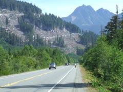
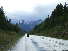
Riding south toward Campbell River
Riding south toward Campbell River (View on flickr)

Vancouver Island is about 300 miles long on the highway. We had a pleasant time touring it, but were surprised by the traffic on the narrow road up north (no surprise since we've been on the easy northern roads for so long).

The section from Port Hardy to Port McNeil was quite pleasant, and we really liked Alert Bay, and also went to Sointula. Very nice cycling.

From Port McNeil to Campbell River was quite bad - much of it has no shoulder, and there are lots of big trucks, including logging trucks.

From Campbell River to Nanaimo was rideable, but not terribly pleasant. There was a lot of traffic on a road with adequate shoulder, but certainly too much traffic.

From Nanaimo south, the roads were great, like New England. Small country roads with little traffic and nice views (and nice hills). Very pleasant. Lots of access to the various islands. We used a bicycle-specific map for this area, the "Victoria/Gulf Islands Cycling and Walking Map". It gave lots of information about the various routes and got us off the main highway.

And the Victoria area (especially Sidney) is delightful, with lots of access to everything for cyclists.

Victoria: The touring bicyclist's theme park


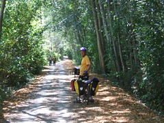
Randy on the Lochside trail north of Victoria
The Victoria area is like a touring bicyclist's theme park. There are beautiful trails like this one (the Lochside trail) leading you all over the city. There are ferries to take you out to quaint islands with few cars. There are sea views everywhere. And cars are extra careful of you. We met many people who just decided to go out for a couple of days and go to an island, or do a little exploration around the main part of Vancouver Island. It's all easy.

Ferry Mixups - On Vancouver Island

Well, we got to Prince Rupert and got ready to take the ferry down to Port Hardy (at the top of Vancouver Island). The main reason for going the Prince Rupert way was so that we could take this beautiful ferry, which goes through the Inside Passage and is supposed to be wonderful.

Unfortunately, I had not really done my homework, and there was no room for us at the inn. We had not made reservations, and it's running completely full due to the tragic sinking of the ferry earlier this year. Well, now we know to call in advance and check it out.

We're having a pleasant time on Vancouver Island - last night was on Sointula, on Malcolm Island, just offshore. We visited Alert Bay, too, and it's definitely a place to go back to!

Boarding the Hyder, Alaska Mailplane to Ketchikan


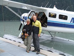
Randy and nancy and russ the pilot of the float plane
Nancy got ambitious while we were in Stewart, BC... She wanted to find a different way out than riding back the way we came to the Cassiar Highway. So she went and talked to the people who run the US mail service just across the border in the ghost town of Hyder, Alaska. And before you knew it, we were loading our bikes into the back of a Beaver floatplane and jamming ourselves in and we ended up in Ketchikan, Alaska, which was never on our agenda! But next we'll go to Prince Rupert, BC (which was) and then to the Queen Charlotte Islands (which weren't until recently).

We saw the Northern Lights!


DSCF0141 dease lake
It seems impossible, but we saw the Northern Lights! It seems like we hadn't even seen a real dark night yet, but it must have been creeping up on us as we ride south and the summer slips away.

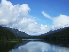
One night we were camped right on the beach at the south end of Dease Lake, which is a long north-to-south lake. When we got up to pee in the night, lo and behold the stars were in the sky, but the whole north part of the sky was lit up with something else. It wasn't residual sunlight - it was all kinds of other colors and flavors. We couldn't believe it. Sorry - it wasn't bright enough for a photo!

Touring Cyclists' Report on the Cassiar Highway

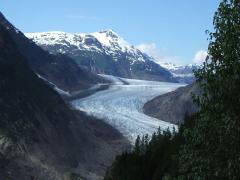
Salmon Glacier
Salmon Glacier (View on flickr)
We wanted to write a quick report on the Cassiar Highway for other touring cyclists. We had a good trip (2006, north-to-south), and some things were easier than expected.

  • The Cassiar is a cyclist's delight, even though we had a fairly rough time with it. The traffic is light, the road is generally good, and the services are more frequent than we expected.
  • The road is mostly paved (about 90%) and not too difficult. There are plenty of hills, but no huge passes. The 10% that is not paved can be fairly difficult (it was all mud for us, and we hate mud). But it's not really all that bad. They expect to finish all the paving in the next couple of years.
  • We found groceries at several places we didn't necessarily expect them. The stores at Good Hope Lake, Dease Lake, Iskut, and Stewart all had groceries. All of those except Good Hope Lake had excellent variety. However, there was nothing at Meziadin Junction. The kind woman at Moose Meadows (north of Dease River Crossing, which is north of Dease Lake) also stocks some imperishables just for the cyclists who come through.
  • Go to Stewart and Hyder. You'll regret passing them by, even though they're off the route. You'll want to see the glaciers and the bears at Fish Creek!
Syndicate content