Route through Honduras
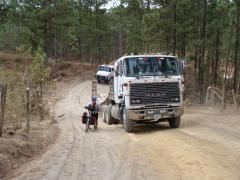
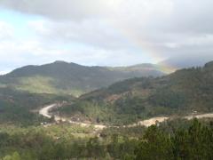
You may remember our friend Tim Malloch that we met in the north of Mexico, in the Copper Canyon region. He was headed north, and we south, and like all travelers we meet, we pestered him with lots of questions about his route and his favorite places along it. We remembered him telling us that the back roads from Santa Rosa de Copan to La Esperanza were his favorite section in all of Central America. So we set out to follow his route. We suspected, but didn't know, that it would continue the really tough mountainous route that we'd already been struggling with in Guatemala. But we took it, and he was right, it was delightful. We spent several days with nearly no traffic, delightful pine-covered hills, and interesting people tucked back in remote valleys. We passed by little roof-tile making operations (apparently the clay is good in this area) and climbed through some of the most remote areas we've been in since northern Mexico. In one town we found no available hotel or "hospedaje" (cheap hospitality) but the mayor happily opened up the municipal offices and settled us in the community meeting room. We had all the comforts of life including a bathroom and a cold shower (which was one of the lesser cold showers we've had). All gratis, thanks to the kind mayor and town of San Miguelcito.
After finding our way through the beautiful country we had one more day of really nice riding before we landed at Honduras' main north-south highway, and it turned out to be so beautiful. Some kind of weather system moved in and we spent half our day climbing a pass in complete dense clouds, passing vegetation-rich creeks that flow out of a major forest reserve. We could hardly see anything, but we imagined what was behind those beautiful creeks coming out of the pine forests. (We're seeing our last pine forests in the next couple of weeks, because they don't grow any farther south than Nicaragua.)
When we did hit the main highway it was a bit of a shock. All that traffic. We did OK, because there was a fair shoulder. There were just two problems: We were exhausted, and the shoulder was kind of a string of huge potholes. So it was great to have a shoulder, but you had to constantly surf it in and out, going back onto the highway or dropping off to the right of the whole road.
When we got to the first of the big climbs headed up toward Tegucigalpa, we just sat and looked at it and could not summon the courage to start up with our fatigued legs. We ended up gatting on a bus with the bikes "just to go to the top of the first hill" but ended up staying on right into Tegucigalpa, the capital, about 35 miles. We had debated a lot about whether to ride into "Tegus", as it's called, as many cyclists have described it as a nightmare, so staying on the bus right into town resolved our discussion.
We are making some progress at getting back in shape. It's pretty rugged go to come back here after 4-6 months (and being sick at that) and hit these mountains that tax us nearly every day. But perhaps it's the quickest way to get back into it. The good news is that we're up in the high country where the climate is pleasant, especially in the early morning. The bad news is that it's mountain after mountain, and we tire easily.
I have to admit it's a little discouraging to find ourselves going 30 miles and being worn out. But perhaps we'll get back in shape, and maybe we'll be able to get farther in a day once we get to some of the lowlands that we think lie ahead of us in Nicaragua.


