Blogs

Cassiar Highway and Beyond, way beyond.

[Note that NEW PHOTOS are posted on the Photos page...]

I can not even remember how long it was since we started our ride south on the Cassiar Highway, since the bugs ate me alive at the Junction of 37 and the Alaskan Highway.

Was it a week ago we started, or was it two or three ago. I can not even remember what day today is. It is not that I have a memory problem or any more then usual. It is just days and nights run into each other and all the markers that keep track of the day are left behind when we travel each day to a new place.

There is a common thread that keeps it all together. Bugs, bugs and more bugs. There is now reason for this many bugs. I am currently trying to recover from a bite that got me a week ago in the eyelid, swelled it up so bad I look like I just got out of the boxing ring. The rain was something that dampened out spirit and has been a thread of commonality. Currently we are in Ketchikan, Alaska hiding out at Alltec Computer store updating our website which is really avoidance from going out and getting wetter then wet. It seems we really are wimps but we are working on getting ready for the West Coast ride down the USA through Oregon. Also another common thread is the amazing wonderful people we meet that share so much with us. Wow! People are really wonderful. Thank you all for your gifts of generosity.

The Cassiar Highway was great in most parts and really bad in others. Most of it is a grade A bike touring road and about 15 percent is really bad.  read more here... lee mas aquí... »

Touring Cyclists' Report on the Cassiar Highway

Salmon Glacier
Salmon Glacier (View on flickr)
We wanted to write a quick report on the Cassiar Highway for other touring cyclists. We had a good trip (2006, north-to-south), and some things were easier than expected.

  • The Cassiar is a cyclist's delight, even though we had a fairly rough time with it. The traffic is light, the road is generally good, and the services are more frequent than we expected.
  • The road is mostly paved (about 90%) and not too difficult. There are plenty of hills, but no huge passes. The 10% that is not paved can be fairly difficult (it was all mud for us, and we hate mud). But it's not really all that bad. They expect to finish all the paving in the next couple of years.
  • We found groceries at several places we didn't necessarily expect them. The stores at Good Hope Lake, Dease Lake, Iskut, and Stewart all had groceries. All of those except Good Hope Lake had excellent variety. However, there was nothing at Meziadin Junction. The kind woman at Moose Meadows (north of Dease River Crossing, which is north of Dease Lake) also stocks some imperishables just for the cyclists who come through.
  • Go to Stewart and Hyder. You'll regret passing them by, even though they're off the route. You'll want to see the glaciers and the bears at Fish Creek!

Breakdowns!


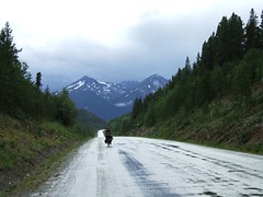
DSCF0127 nancy riding in the rain
Starting down the Cassiar, it seemed like everything was breaking down. We felt tired (even though we'd just taken a couple of days off at Watson Lake) and didn't seem like we were making the distance we expected. And it seemed like it was raining and cold every day. We were starting to get worried that we were going to "blow out" and get too discouraged to continue, as we've all seen happen with big tours before.

And then approaching Dease Lake in a horrible dirt-road section I broke a spoke in my rear wheel. We spent a day cleaning up and repairing and resupplying, and then spent a couple more days resting in Telegraph Creek.

Touring Cyclist Tip: Cleaning your chain on the road with diesel in a peanut butter jar

We had a VERY BAD MUD DAY right before we got to Dease Lake, and finally tried out a tip we'd heard before, and it worked great. We were able to get the bikes *really* working well again with a good cleaning.
  1. We're using the SRAM quick-connectors on the chain, so we just took opened the chain up using those. (Nancy has a Shimano chain, and the connector works on those, too.) If you didn't have that, you'd have to break the chain the old fashioned way.
  2. After removing the chains, we put them in a bit of diesel in a small peanut butter jar and shook and let it sit awhile.
  3. Then I wiped every link carefully with a rag
  4. Finally, we let the chains dry just a bit, then applied some new lube.
  5. And the next day we put more lube on, because the diesel remaining in the chain dissolved a lot of the original lube, of course.
Voila! The chains were as good as new! No more crunch crunch from the mud/sand. Maybe I won't be quite so unhappy in the future when we have a bad mud day, knowing that I really can clean it up right.

His Mama didn't train him right

We have had some really nice road and some excellent motorists. In fact, we'll look back on the Cassiar and Klondike and Dempster highways with fondness because the traffic was light and the riding good.

But there are a few motorists whose Mama just didn't train them right.

I'm sure *your* Mama taught you that when passing a cyclist or a pedestrian on a dirt road or in the rain that you should slow down so you don't slop all over them. And didn't your Mama teach you to give a cyclist a wide berth when passing... and if you can't pass safely right now, then slow down and wait until you can.

Most of them are great, some some can use some more training!

Big Trip Canada Photos (Summer, 2006)

Watson Lake Signpost Forest


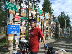
randy at watson lake forest sign
Watson Lake was a major construction staging area for the Alaska Highway back in 1942 and a lonely GI put up one sign pointing the way to his home town. Now there are more than 40,000 of them. Nancy got lost looking around at them and I didn't find her for hours.

Nancy put our "hobobiker" card and sticker in a ziplock and duct-taped it to the back of a metal sign. It's not much in this incredible forest, but it's lightweight and minimalist for bike tourists :-)


You are HERE: Watson Lake


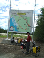
watson lake map
We've just ridden about 450 miles on the Alaska Highway and are about to turn south on the Cassiar Highway toward Dease Lake. Here's the map so you can all see where we're headed. We go on the left side of this down to Dease Lake (with a probable side trip to Telegraph Creek) and to Stewart and Hyde to see the bears eating salmon at Fish Creek..
Syndicate content