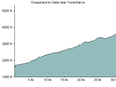
August 18, 2008: Chuquicara to Camp 8km before Yuracmarca
Leaving Chuquicara, make sure you go straight and don't cross the bridge - follow the river, not the pavement. On the correct road, there is no pavement, and it is easy to follow the pavement instead of the correct road. There are several restaurants along the way, and one tiny town, called El Mirador. Despite the fact that everybody said there was nothing, we had a nice lunch, and various opportunities to get water and food. There were 10 short tunnels, and it was a beautiful, inspiring day (all quite rough dirt road).
- 30 miles/48 kilometers
- Elevation Gain: 2063 feet/637 meters
- Where we stayed: camp
- Download GPX file
- Download KML file
Elevation Profile

