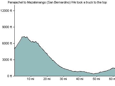
July 14, 2007: Panajachel to Mazatenango, Guatemala
Got a ride to the top, then did the 55 miles (mostly easy) CA-2 hwy was ugly; wide, but too much traffic. Stopped in San Bernardino just outside of Mazatenango at a couple of decent hotels. Much nicer than in town.
- 55 miles/89 kilometers
- Elevation Gain: 1100 feet/340 meters
- Where we stayed: hotel
- Download GPX file
- Download KML file
Elevation Profile

