Home
Español
FAQ
Photos
Gear
Search
Contact
Home
The Americas
Canada
Blog (In Order)
Route and Triplog
Photos
Wonderful People
USA West Coast
Blog (In Order)
Route and Triplog
Photos
Wonderful People
Mexico
Mexico section blog (in order)
Route and Triplog
Wonderful People
Photos
Central America
Central America Blog
Route and Triplog
Photos
South America
South America Blog (in order)
Colombia
Ecuador
Peru
Bolivia
Argentina
Route and Triplog
Photos
Earlier Trips
Mexico (2003)
Blog
Thanks!
Trip Log
Great Divide (2003)
Blog (In Order)
Photos
Wonderful People
Trip Log
Northwest (2004)
Photos
Route
Thanks
Trip Log
New England (2005)
Photos
Route
Thanks
Trip Log
FAQ
Gear
Route Maps
Canada
USA
Mexico
Central America
South America
Colombia
Ecuador
Peru
Bolivia
Argentina/Chile
Topics
Podcasts
Tips for Travelers
Agua Para La Vida
Microfinance
Kiva.org
Friendship Bridge
Maps
Other Cyclists
Route Reports
Home
‹ Desert south of Parral to Las Nieves, Durango
Up
Desert, Durango to Desert, Durango ›
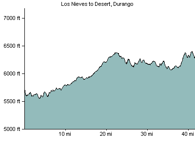
March 24, 2007: Las Nieves, Durango to Desert
To navigate, press the arrow keys.
Explore in Google Earth
More desert slog south. We felt a bit better.
41 miles/66 kilometers
Elevation Gain: 2007 feet/619 meters
Where we stayed: camp
Download GPX file
Download KML file
Elevation Profile
‹ Desert south of Parral to Las Nieves, Durango
Up
Desert, Durango to Desert, Durango ›
BESbswy