Canada Big Trip Blog (In Order)
Feel free to email .
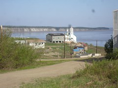
We made it to the Eagle Plains Hotel!
Well, it took us six days but we made it to the halfway point on the Dempster Highway, the Eagle Plains Hotel. We've had a wonderful time - quite a stretch for us to do something this hard as the first thing on the tour, but we're well. The weather has been incredible. Because there's no night, the earth gets lots of warmth from the sun this time of year. In our first couple of days the temperature was in the 80s and 90s Fahrenheit! Really hot.
No bears! Nancy's worry level may be decreasing - she spent a lot of time talking with a woman whose extensive experience in the wild in this part of the world (and no problems with bears) gave Nancy more confidence to deal with possible encounters (and less fear that we'll have them).
And so far the mosquito season has hardly started. We have plenty of bites, but it's the kind of thing we've experienced before, not the intense disaster people talk about in July up here. However, we have a long ways to go... But we have mosquito outfits and spray and such.
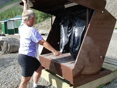
Today we're taking a day off and just resting here at the Eagle Plains Hotel. We swapped a night's lodging and dinner with them in exchange for developing a website - http://eagleplainshotel.com - that they've never had before.
Beginnings
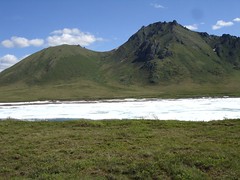
Well, we've been out for a week and have met the most amazing people. The stories that we're hearing are phenomenal. Between the stories are many incredible landscapes - the awesome Richardson Mountains that form the divide between the Arctic watersheds and the Pacific, between The Mackenzie and the Yukon.
No bears but lots of bear scat. I'm calming down a little bit.
We'll try to get some pictures uploaded and write some of the wonderful stories we've heard when we get to Dawson.
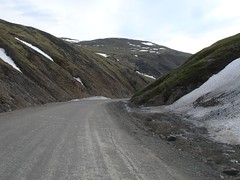
North Fork Pass
Dempster Highway Photos
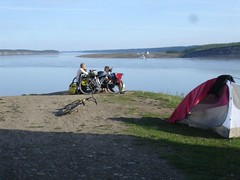
We're getting showers, even when wild camping!
Christof and Gernot just starting north
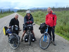
We've met quite a number of cyclists here in Dawson City. What a treat to compare notes with new friends.
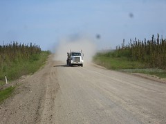
Truck bringing dust our way - near Fort McPherson
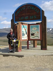
The Arctic Circle
The 24-hour day (and near-24-hour-day) that we've had is amazing. It's really light all the time. We have not used our camping headlights and won't for some time yet. We did bring blindfolds for sleeping at night and they've been fantastic.
Despite the 24-hour day, there is still a cycle to things. It cools off quite a bit at night, and warms up in the day. The insects know about the cycle and function quite adequately.
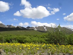
As you've seen from our pictures, nearly everything is fully summertime here, just like you'd see at home in the Rocky Mountains. Apparently, even though the sunlight is filtered by much more atmosphere to get here, the fact that it's shiniing for 24 hours means that the earth absorbs as much solar radiation in the 24 hours as it would in 12 hours at the equator, and that's the reason for the glorious summer.
North fork pass views
Nancy's horrible mud bike
Posted 26 minutes ago. ( permalink | delete | edit )
Camping at Tsiigehtchic in back of the church overlooking the rivers at Tsiigehtchic
Anthony dad, Russel, helps run the ferry which you can see in the far distance. This one just one of the three ferry crossing we have used so far. A bridge can not be built here because of the freezing and thawing of the river is too mighty it has knocked down bridges that have been built before.
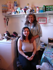
We needed shower desperately so we asked Russel where we could get a shower at Tsiigehtchic. He said just go to his house and help ourselves which we did. He had a lovely home in this great village. Thanks Russel for the showers and the stories of your life. We highly recommend you all take the ferry to Tsiigehtchic and visit with the people here. Look up Carol Norwiegnin and her mom. Carol walked 125km to Inuvik to raise money for cancer. We meet he and her mom, a survivor of cancer, on the road. We have
Airstrip warning near Eagle Plains
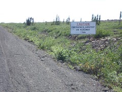
This sign has a new meaning of share the road.
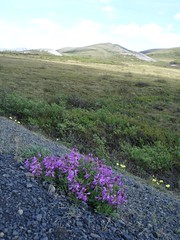
Purple flowers
Steep Richardson mountain climbs
Tsiigehtchic
Terry and Carol in their store at Tsiigehtchic
Bike Touring The Dempster Highway - Our Report
- Resources
- The Milepost is essential. Copy or rip out the section about the Dempster and you'll know where every pullout and campground is.
- Alys and Pete's book Alaska Bicycle Touring Guide is getting mighty old, but it's the only place you can find out where water is available. That's something that matters to a cyclist and not to most other travelers.
- Journals from other riders who did the Dempster: Jeff Kruys (2006), Murray Snyder (2006), Mike Vermuelen (1996)
- Things you'll need
- Mosquito headnet (or full body suit) and repellent. Mostly we liked the headnet instead of repellent.
- Bear Cache/Cannister (or see our note on using garbage cans as a cache)
- Eye protection - lots of dust and things flying.
- Water capacity enough for the 100km section of no water between Eagle Plains and where the Ogilvie River leaves the highway.
- Water filter or chemicals
- Spare tire and tubes. We had no problems, but plenty of cyclists and motorists have had destroyed tires from the sharp shale sections.
- General notes
- Don't forget that you can't get across the Mackenzie or Peel Rivers during freezeup or breakup. You'll need to know when the road is likely to open if you want to travel those stretches.
- You can send half your food ahead to Eagle Plains - mark the box with your name and "please hold for cyclist". You can typically arrange this at the visitor center in either Dawson City or in Inuvik. There are a lot of kind motorists travelling this route.
- Almost everybody travelling this road is actually a friend and a support vehicle. In case of bike trouble, water trouble, etc., you'll probably come out OK by asking for help.
- The road was pretty fair quality dirt road when we went. It's way better than most dirt roads I've travelled, both in terms of grade and quality. However, some sections turn to horrendous mud in the rain, and of course cyclists hate the mud. You may want to leave your fenders at home.
- You can camp at gravel pits, rest stops, etc., in addition to the campgrounds. In a number of places it's hard to camp on the swampy or permafrost areas off the highway except in these places.
- Spend some time hiking at Tombstone if you can.
- Eagle Plains Hotel had fair prices (only $10/night for camping - included the shower! - although there was a place for quarters you didn't have to use it.)
- You can buy some food from the kitchen at Eagle Plains, but they don't have anything in their store. But you can probably get a loaf of bread, for example.
- Engineer Creek Campground has unthinkable water. Get water just downstream at the Ogilvie River bridge instead and haul it to the campground.
- Fort McPherson has most services, but Tsiigehtchic (Arctic Red River) has basically none.
- Tires and bike: I used a mountain bike with Continental "Traffic" tires, and Nancy used a touring bike with Shwalbe Marathon XR tires. These worked great. I do recommend some tread and a wider tire for this route.
- The 100km section between where the road leaves the Ogilvie River (northbound) to Eagle Plains has no good water. Plan to get water there or at Eagle Plains (southbound) for this section. A motorist might cache some water for you at a kilometer marker as well. Kilometers are marked on even kilometers and most of the markers are there.
Delightful trip to Whitehorse
We made it to Whitehorse, the capital of the Yukon. We had a great trip - some new friends, some rain, some sun. A bit slower than we had expected.
When we rode into Whitehorse we saw the first traffic light of the trip. We've been almost 800 miles without seeing a traffic light! Where can you do that?
Today our friend Rob Ungless is flying in from Vancouver and we're going to ride down to the sea and visit southeast Alaska. I don't expect to be able to post anything more for a few days, but hopefully we can get you some pictures of the wonderful Klondike and Yukon area.
In Juneau - and links to Klondike + Juneau PIctures
And here are some new pictures from the most recent two legs of the trip:
- Dawson City to Whitehorse: all (float over for descriptions) or slideshow
- Whitehorse-Skagway-Juneau-Haines Loop: (updated again July 14)all (float over for descriptions) or slideshow