Up the Utcubamba River Valley to the land of the Chachas

From San Ignacio we descended rapidly into a completely different kind of country - rice paddies everywhere. Neither of us had ever seen the cultivation of rice before, so we were amazed to see the effort required to work with the plants at the various parts of their life cycle. It was beautiful, too, but like we had left the high mountains and landed in a south-east Asian area!
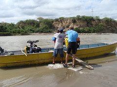
After about 50 kilometers of dirt (formerly paved, but long since decayed) we hit beautiful new pavement for the first time in days. And it was downhill, too. But we soon turned off for a shortcut that we read about in Peter Berechree's incredible blog of his Andes-by-bike adventure. We took a dirt-road turnoff to the town of Bellavista and found our way to the banks of the Rio Marañon, a major river headed to the Amazon. Hoping that we'd gotten to the right place, we waved and yelled to a fellow cleaning his boat on the other side, he eventually came for us. We loaded the bikes up a 2x4 ramp and crossed over in a jiffy, then road a few miles to catch the highway again. We got a pleasant little diversion from the highway and probably eliminated 50 kilometers from our route.
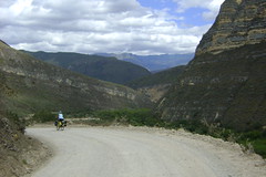
Soon we were starting up the beautiful valley of the Utcubamba River, which we would follow for something like 130 kilometers (75 miles). For the first section it climbed rapidly and we looked at the rapids of the river below wondering whether they were runnable in a kayak, remembering our favorite sections of rivers in Colorado, but feeling simply fear looking at these rapids.
At Pedro Ruiz we hit a stretch of highway construction which closed the highway during the day, so we loaded the bikes on an evening microbus for the quick trip to Chachapoyas, the former capital of the Chacha people, who were conquered by the Incas in about 1500. We were headed for their most impressive fortress city, Kuelap. Riding further along the Rio Utcubamba, we got to a little place called El Tingo, where we hoped to organize a ride up to the ruin, but it turned out that there is almost no reliable transport. (It is a 10 kilometer, 1300 meter, 3-4 hour walk up to the ruins on a trail, but we wanted to take a rest day.) We weren't able to organize anything in El Tingo, but Nancy insisted that we call some agencies back in Chachapoyas, and we succeeded in getting one of the tours out of Chachapoyas to pick us up the next day. But Kuelap was an amazing site, built apparently as a fortress high on top of a mountain, much like Macchu Picchu was for the Inca. When the Incas conquered the Chacha people, they forced everyone out of the fortress, so it was hardly a factor when the Spanish conquerors came just a few years later.
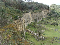

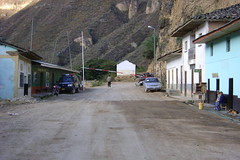
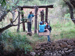
Ironically, the things we'll probably remember most about this stretch of the trip will not be the impressive fortress, but the joys of bike touring. On the way up the river we were yelled at by two workers from across the river - their cable car, the only way they had of getting across, was on the wrong side of the river. So they coached me on how to get in and take it across to them, and then we all came back across together. And in Tingo, we had time to do what the few other residents did. We just sat on the bench by the police station or in front of the little restaurant and watched the few people go by. A burro-load here, a microbus there. Perhaps an old woman carrying a load of firewood. Seeing the police lift the gate for a truck passing through. Just watching the little parade was all there was to do. And we stayed at the delightful and quaint little Hospedaje Casa León that looked like something from another century, but still had hot water in one of the bathrooms.
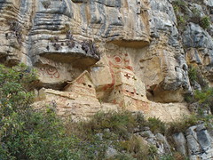
From El Tingo we rode still farther up the road until Nancy happened to spot a sign announcing the turnoff to another famous archaeological site of the Chacha people, Revash. We rode up a canyon about 5km and then hiked high up the canyon wall to see the ancient burial site. It certainly reminded us of an Anasazi site from the American southwest, but in miniature, as it was a burial site, instead of a place to live.
Despite the significant detour, we did get to Leymebamba that night just at dusk, ready to arrange transportation across the huge valley ahead to Celendín.
